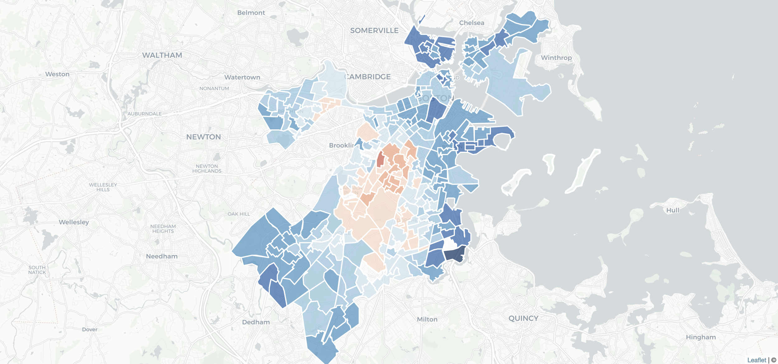
Data: How Boston voted
I gathered city data from the preliminary election (delivered via PDF) and practiced cleaning it via a text editor and Excel. I joined the results to the precinct shapefile in qGIS and exported them in geoJSON, which I then used to power a series of Leaflet maps.
The preparation paid off as we were able to publish the maps just a few hours after receiving the data from the city.